The AI Tutor is capable of doing all sorts of clever things; if you just know what to ask.
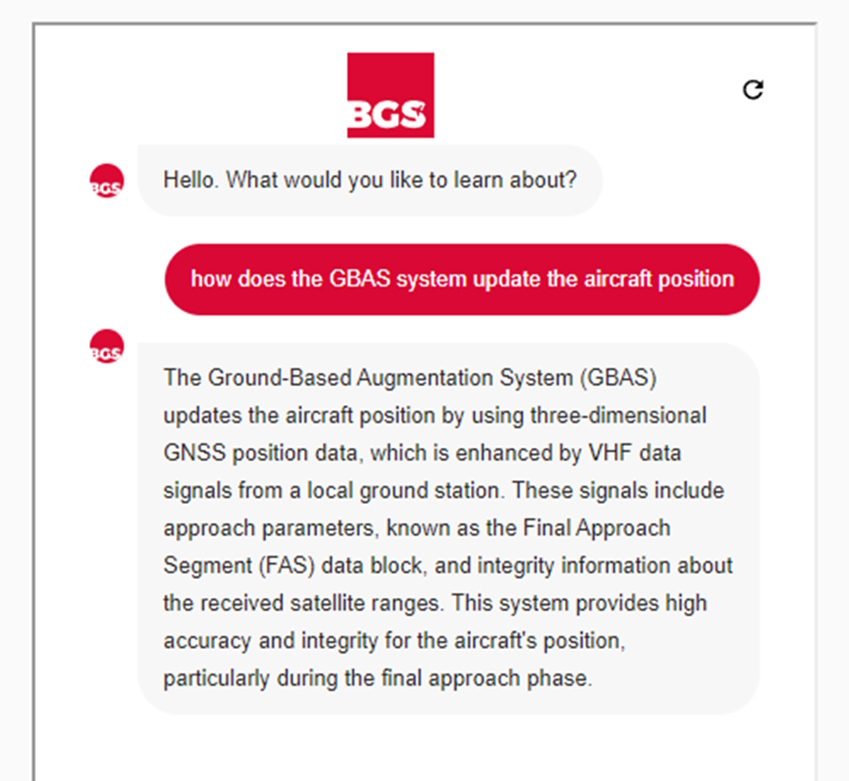
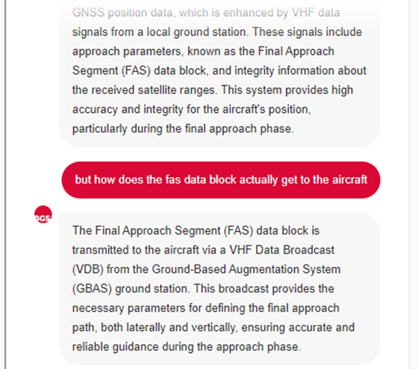
The first and most obvious way to utilise it is to ask it questions and follow-up questions in a conversational way
Example:
The next thing I recommend trying is to ask it for specific resources or formats. The AI Tutor is particularly good at producing summaries or bullet-point lists
Example question:
“Please provide a bullet point list to explain how gbas works that i can use for revision”
AI Tutor response:
- Ground Station Measurements: GBAS makes measurements of signal errors transmitted by satellites at a single ground station.
- Error Correction: These measured errors are relayed to users to correct raw GPS data to a high level of accuracy.
- Error Types Corrected: GBAS corrects for errors induced by satellite clocks, ephemeris, and ionospheric propagation.
- Limitations: It cannot correct for receiver errors, multipath signals, or some atmospheric propagation errors.
- Positioning Service: Utilises GPS position correction and integrity monitoring elements of the VDB signal for accurate navigation in terminal areas.
- Network Capability: ICAO standards allow interconnection of GBAS stations to form a network for large-scale differential corrections, known as GRAS.
- Operational Range: The normal operational range for a GBAS station is approximately 20 nautical miles (NM).
- Precision Approaches: GBAS is used to create precision approaches, currently down to 200 feet, with potential future improvements to achieve CAT 3 approach equivalency.
You can also treat the AI Tutor like it is a virtual instructor (or “Tutor”!), asking it to do things like quiz you on specific topics. Here’s an example conversation of us doing this:
User (Matt): “Please quiz me on how GBAS works”
AI Tutor: “Certainly! Here are a few quiz questions about how Ground Based Augmentation Systems (GBAS) work:
What is the primary function of a GBAS?
- A) To provide weather updates
- B) To improve the accuracy and integrity of GPS signals in local areas
- C) To broadcast entertainment channels
- What is the approximate normal operational range for a GBAS station?
- A) 10 NM
- B) 20 NM
- C) 50 NM
- What type of errors does GBAS correct for?
- A) Receiver errors
- B) Multipath signals
- C) Satellite clock, ephemeris, and ionospheric propagation errors
- What is the GBAS positioning service used for?
- A) To provide more accurate navigation in the terminal area
- B) To enhance in-flight entertainment
- C) To monitor passenger comfort levels
- What is the term used for the data block transmitted by GBAS that defines the final approach path?
- A) FAS data block
- B) GPS data block
- C) VDB data block
Feel free to answer these questions, and I can provide feedback on your responses!”
User (Matt): 1 is b, 2 is b, 3 is c, 4 is a, 5 is a
AI Tutor: “Let’s review your answers:
- What is the primary function of a GBAS?
- Your answer: B) To improve the accuracy and integrity of GPS signals in local areas
- Correct answer: B) To improve the accuracy and integrity of GPS signals in local areas
- What is the approximate normal operational range for a GBAS station?
- Your answer: B) 20 NM
- Correct answer: B) 20 NM
- What type of errors does GBAS correct for?
- Your answer: C) Satellite clock, ephemeris, and ionospheric propagation errors
- Correct answer: C) Satellite clock, ephemeris, and ionospheric propagation errors
- What is the GBAS positioning service used for?
- Your answer: A) To provide more accurate navigation in the terminal area
- Correct answer: A) To provide more accurate navigation in the terminal area
- What is the term used for the data block transmitted by GBAS that defines the final approach path?
- Your answer: A) FAS data block
- Correct answer: A) FAS data block
- Well done! You got all the answers correct.